- April 18, 2024

-
-
Loading
Loading

Hurricane Michael pushed newly placed sand on Longboat Key’s north end beach toward Greer Island and its mangrove lagoon, said town officials who are assessing the offshore storm’s effects on its beaches.
“We’re still hoping to get some aerial shots,” of the north end beach nourishment project, said Al Browder, the town’s coastal engineer. “The water level did not get high enough to go into someone’s house.”
The town spent $1.1 million in September to replace 30,000 tons of sand on a stretch of 600 feet of gulf beach that sits between two groins. The goal of the beach nourishment project was to mitigate the effects of previous beach erosion on the north end of the island.
“There was some shifting around of sand, but no net addition,” Browder said. “We were fortunate the hurricane was offshore.”
Michael, which landed in the Panhandle as a Category 4 but stayed about 200 miles off southwest Florida's coast, sent swells across the Gulf of Mexico along with minor storm surge. Those waves, in turn, were able to move the sand away from the groins faster than anticipated.
“We saw some evidence of scarping too,” he said of the cliff-like formations left behind by breaking waves. “It’s a foot or less of dune scarping. Nothing worrisome.”
Days after the storm's passage, in a sea-level rise presentation at the Oct. 15 commission meeting, Will Reilly, a senior engineer with Aptim Environmental & Infrastructure Inc., said the sea level in Longboat may rise two-to-six inches by 2030 and has been rising since 2010. Currently, Longboat Key’s sea level rises at a rate of .11 inches annually.
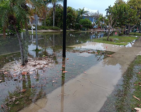
Reilly said the town is prone to storm surges and needs to be concerned about its low-lying streets, particularly its main thoroughfare, Gulf of Mexico Drive.
“Before 1980, there were some significant flood events in Longboat,” Reilly said. “And rain events are getting stronger.”
To combat potential flooding issues on the island, Aptim suggested the town make storm water improvements on GMD and continue with the installation and evaluation of its backflow devices on storm sewers. Aptim also said the town may need to investigate a more comprehensive storm water management plan, and should investigate the purchase of a high-water vehicle, something Fire Chief Paul Dezzi is already looking into, said Mayor George Spoll.
Aptim’s report also said there is “insufficient incentive to elevate or redevelop non-flood compliant structures.” Reilly said the town – which is in the process of revising its zoning ordinance – could hold classes on flood compliance and offer rebates on building permits.
“A large number of homes were built before 1974,” said Aptim’s Lead Coastal Engineer, Doug Mann. “The Village is at ground zero for sea level rise.”
At the urging of Town Manager Tom Harmer, Longboat officials will begin looking for ways to fund some of Aptim’s suggestions.