- April 18, 2024

-
-
Loading
Loading
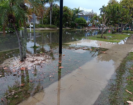
It might be a while before a dredge crew can begin moving through the town’s public canals, but last summer’s red tide outbreak could end up playing a role in cutting the cost of the project.
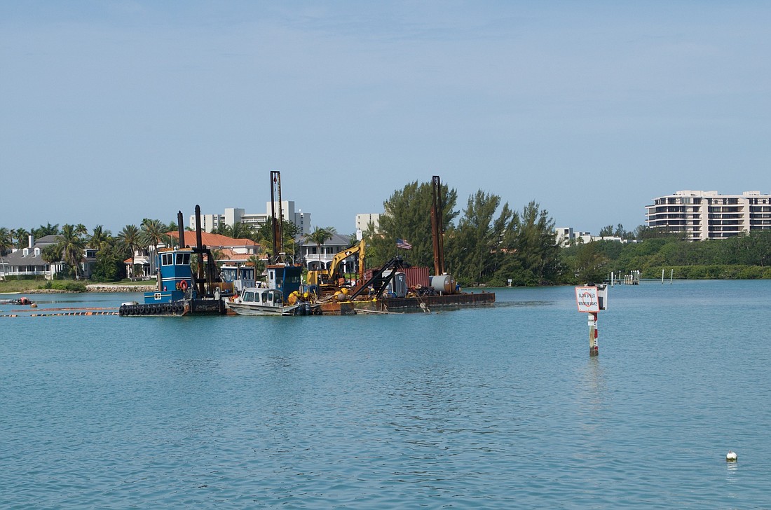
Plans have been discussed for at least three years, and consultant Taylor Engineering Inc. updated town commissioners in April 2017 on the town’s Canal Dredging Feasibility Study.
At the time, the consultant identified 16 of the Key’s canals as “priority canals,” or those most in need of dredging to a depth of 3 feet below mean low water. This list included Canal 1A, which connects the lagoon of Greer Island to Sarasota Bay. That number was later revised to 14 canals and the Greer Island Beneficial Use Project, aimed at opening better access between Sarasota Bay and the lagoon along Greer Island, was identified. Material would be added to the gulf-side of the island to help bulk it up against wave action and erosion.
In 2017, the cost estimates ranged from $1.25 million to $2.35 million for about 20,000 cubic yards to be removed. The town received some good news in the form of $300,000 pending from the West Coast Inland Navigation District to help with the project.
So, last fall, it looked like the project could advance in 2019, if permitting went well.
And now? Public Works Director Isaac Brownman recently told commissioners there was a problem.
Before the first grain of sand can be sucked off the bottom of the first canal, the town must have in place a detailed plan to plant seagrass acreage in a 2-for-1 ratio to mitigate any disturbed in the dredging.
Beyond a simple location to use for mitigation, which isn’t easy to find, data on soil, design and other factors must be accounted for.
In other words, damage done to an acre of seagrass while dredging would require the town to plant 2 acres elsewhere, much in the way a homeowner plants St. Augustine grass plugs in backyard bare spots — just with a lot more permitting requirements.
That wasn’t accounted for in previous cost estimates.
“One of the key issues, in fact, the key issue, is the amount of sea grass we determine we have to mitigate,’’ he said. “A, I don’t believe we, nor our engineering consultants, knew how much seagrass was going to be impacted and B, the ratio being at a two to one, trying to find 4 acres worth to mitigate, that’s been the challenge.’’
The financial burden is not known, but it could rise “beyond the capacity to fund under our current general fund budget source,’’ according to a memo from Brownman.
“There really should have been, in my opinion, a line in that table that said ‘mitigation costs to be determined,’” Brownman said. “Because it was unknown at the time. To me that was a big missing component.”
In 2017, a sea grass survey of the town revealed about 1.89 acres of seagrass that likely would be damaged in dredging. That would mean about 4 acres would have to be planted to satisfy the 2-for-1 ratio.
So town officials are looking into options.
Among them: the possibility a new survey, to see what the new reality is after 2018’s red tide outbreak. The town wanted to perform such as second look last fall and winter, but first the red tide outbreak got in the way. Then the December federal government shutdown did, too.
“So we’re looking to reapproach and talk to the Army Corps of Engineers about re-baselining the project,’’ Brownman said. “Let’s spend a little bit of money, to resurvey those impacted areas. We believe, and so does the environmental consultant believe, we can really shrink down that mitigation requirement because were going to be working from a baseline of a lot less seagrass.’’
But to avoid inadvertently ending up with the same result, and paying for it, Brownman said the idea would be to pay attention to the early results of that re-baseline survey and see if they match up with the expectations of less seagrass activity.
“We don’t want to pay for an entire survey, so we just say, ‘Stop, it doesn’t look like that’s doing to work,’’’ he said. “But what we’re hearing right now is that there was a significant die off that should reduce our mitigating requirement substantially.
“As much as red tide was terrible, perhaps there’s a benefit here.’’
Among other ideas to reduce the cost, and perhaps scope, of the canal dredging: